
Tairawhiti Tsunami Maps
TSUNAMI
The Gisborne region has experienced several tsunamis over the years. The 1868 Arica (Chile) earthquake generated a tsunami that impacted New Zealand on August 15.
The worst impacts were on the Chatham Islands and Banks Peninsula but severe surge currents also occurred at Gisborne Port and while wave heights were estimated to exceed 1.5m, no reports of damage are known.
The two 1947 tsunamis (March and May) are historically significant events. The tsunami effects were well documented with tsunami run-up heights of up to 10m in the March event accompanied by extensive tsunami surge up coastal rivers. In the May event, a smaller tsunami occurred with wave ~5-6 m wave heights affecting about 50km of the coastline.
The earthquakes that generated the tsunami were relatively weak at magnitude 7 and were not strongly felt by coastal residents. Most recent assessments attribute the large waves to a special class of earthquakes responsible for local tsunami that are much larger than the earthquake magnitude alone would suggest.
The magnitude 9.5 Chile earthquake in May 1960 caused significant damage in Aotearoa New Zealand with wave heights of 4.5m at Napier, damaging a footbridge, wrecking several boats and the Te Awanga campground had several people washed out of their tents. At Whitianga, the waterfront area and airport were flooded, with some small boats washed out to sea. At Lyttelton, the tsunami reached a height of 2.7m and a hotel and several houses were flooded. At Gisborne Port, nearly every boat broke its moorings and jetties were damaged. The harbourmaster reported high waves coming in every 20 minutes and in between the waves the Turanganui river was reduced to a trickle that could nearly be walked across. In September 2016 and 5 March 2021, earthquakes off Te Araroa triggered a small local tsunami recorded at the Lottin Point tide gauge and seen in some coastal areas. There have been several small tsunamis since, coming from a number of sources.
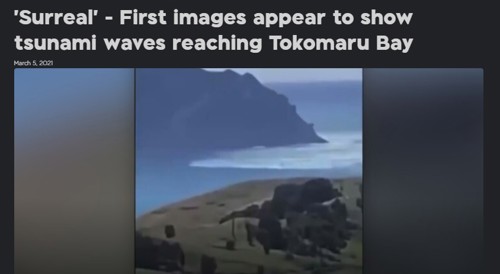
Tokomaru Bay tsunami, 5 March 2021. Photo from 1News
If you live near the coast or inside a tsunami evacuation zone (see the link above to the tsunami maps) you need to have a plan in place. If you feel a big earthquake that is long (goes for a minute or longer) or strong (it’s hard to stand up), or a weak, rolling earthquake shaking for a minute or more, you should self-evacuate. Go immediately to higher ground or as far inland as possible as soon as the shaking stops. If you live outside the tsunami evacuation zone you don’t need to move.

Local Tsunami
If you will feel a big earthquake, you have up to 25 minutes to evacuate.
A big earthquake, such as a magnitude 8.9 centred in the Hikurangi subduction zone, off East Cape, will be long and strong – so get gone.
Tsunami waves could arrive soon after the earthquake and there won't be any time for an official warning, so self-evacuate as soon as the shaking stops.
It's important to recognise the natural warning signs and act quickly.
In some areas it's best to walk or bike if possible, rather than getting into a vehicle and getting stuck in traffic. If you have family inside the evacuation zone, don't try to enter the zone to find them – this can cause traffic jams and slow down the safe evacuation of the area.
If there's no tsunami generated after two hours (for a local event) or Emergency Management advise you sooner, it will be safe to go home.
Listen to a local radio station for updates.
Get ready! You should make plans with your family before an emergency like this happens.
Discuss and organise to stay with family or friends living outside the tsunami evacuation area. Make sure all family members know where you will go. If you have children in a school or childcare centre within a tsunami evacuation area, know what their plans are. Don't wait until an earthquake happens to find out.
Natural warning signs
If you're on or near the coast and feel an earthquake that's long or strong, or you see a sudden rise or fall in the sea level, or hear loud and unusual sounds from the sea, Walk immediately to the nearest safe zone – seek higher ground, or move as far inland as possible.
Don't wait for an official warning – evacuate immediately.
Tsunami waves can arrive in minutes or take an hour. Take your grab bag with enough supplies in case you can't get home for five days.
The Hikurangi Subduction Zone
There is a one in four chance of a magnitude 8 or greater earthquake in the next 50 years. In this video Tairāwhiti Emergency Management manager Ben Green talks about our region's risk and about being prepared.
Read the article on the Hikurangi Subduction zone - where it is and why scientists in Aotearoa and overseas are interested in it - visit East Coast LAB's website East Coast LAB
All of the tsunami maps have both local and distant evacuation zones. You only need to get clear of the evacuation areas not miles inland or on top of the highest peak. If you're on a part of the Coast that isn't covered by one of the maps, you should get as far inland or as high as you can within a 20-30 minute time frame (that's walking quickly, not driving).
If you can take a transistor radio you can listen for the all clear or otherwise you should wait two hours before returning home – if no tsunami has been generated.
Distant or regional-source tsunami
Distant tsunami are made by a very strong earthquake on the other side of the ocean or as close as the Kermadec Islands. The only real credible threat from a distant tsunami to Gisborne communities is from Chile or Peru and will come with around 11-15 hours warning.
A tsunami generated by an earthquake in the Kermadecs could take more than one hour for the inundation to hit and there will be no natural warning signs.
You'll know when they are coming as TEMO will send public messages telling you what you need to do. The primary means of warning people to evacuate will be by door knocking in the areas identified on the maps.
There's no need to panic as authorities will have between 10-12 hours to do this. Those at risk will be advised by community Civil Defence volunteers, Police and Fire and Emergency NZ. There will be information on national media, local radio stations and the TEMO website and Facebook page.
It's possible that evacuations for a distant event could last for 10-12 hours, as there are many surges in an event like this. If inundation does occur, some areas may be closed for some time.
Inundation zones - red, orange, yellow
Here is the link to our latest evacuation maps and tsunami booklet - please read them and know which zone you are in.
 Tairawhiti Tsunami Evacuation Booklet
Everyone in all three zones – red, orange, yellow – must self-evacuate following a long or strong earthquake.
Red zone = the highest risk zone. Evacuate from this zone in all types of tsunami warnings – natural or official, generated from near or far. The Red zone is likely to be inundated by a tsunami generated by a distant earthquake as far off as Chile. There may be many hours before the inundation hits and no natural warning signs.
Orange zone = evacuate from this zone in most, if not all, distant and regional-source official warnings.
This zone is likely to be inundated by a tsunami generated by an earthquake as close as the Kermadec Islands. It could take more than one hour for the inundation to hit and there may be no natural warning.
Yellow zone = local threat, you will feel a big earthquake and have up to 15 minutes to evacuate.
A big earthquake such as a magnitude 8.9 magnitude centred in the Hikurangi Subduction Zone, off East Cape, will be long and strong – so get gone. All zones must evacuate immediately.
The Hui Documentary - Tairawhiti Marae Emergency and Preparedness 2023
Useful Links
Hikurangi Subduction Zone Hikurangi Subduction Zone explained East Coast LAB
Tairawhiti Tsunami and Earthquake Booklet (.pdf)
